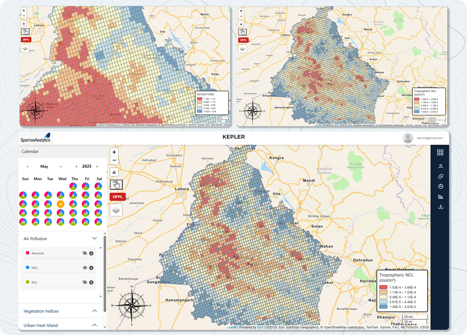
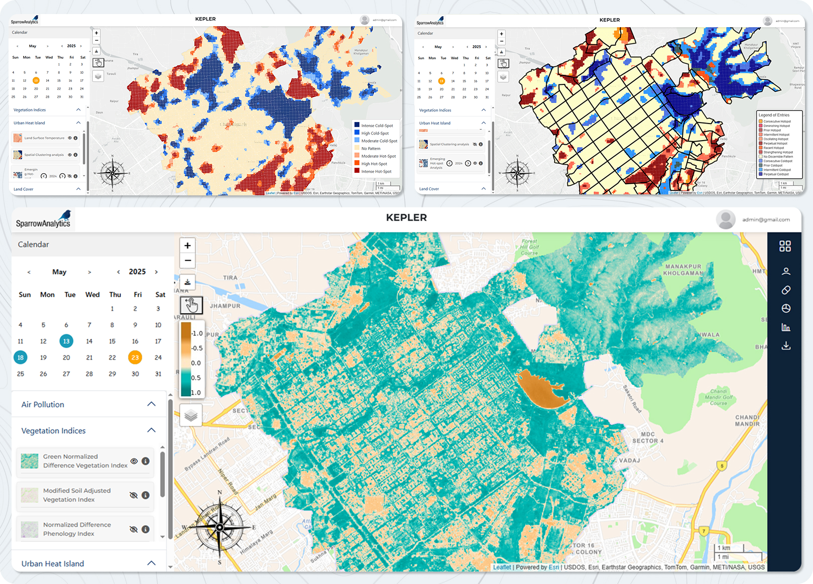
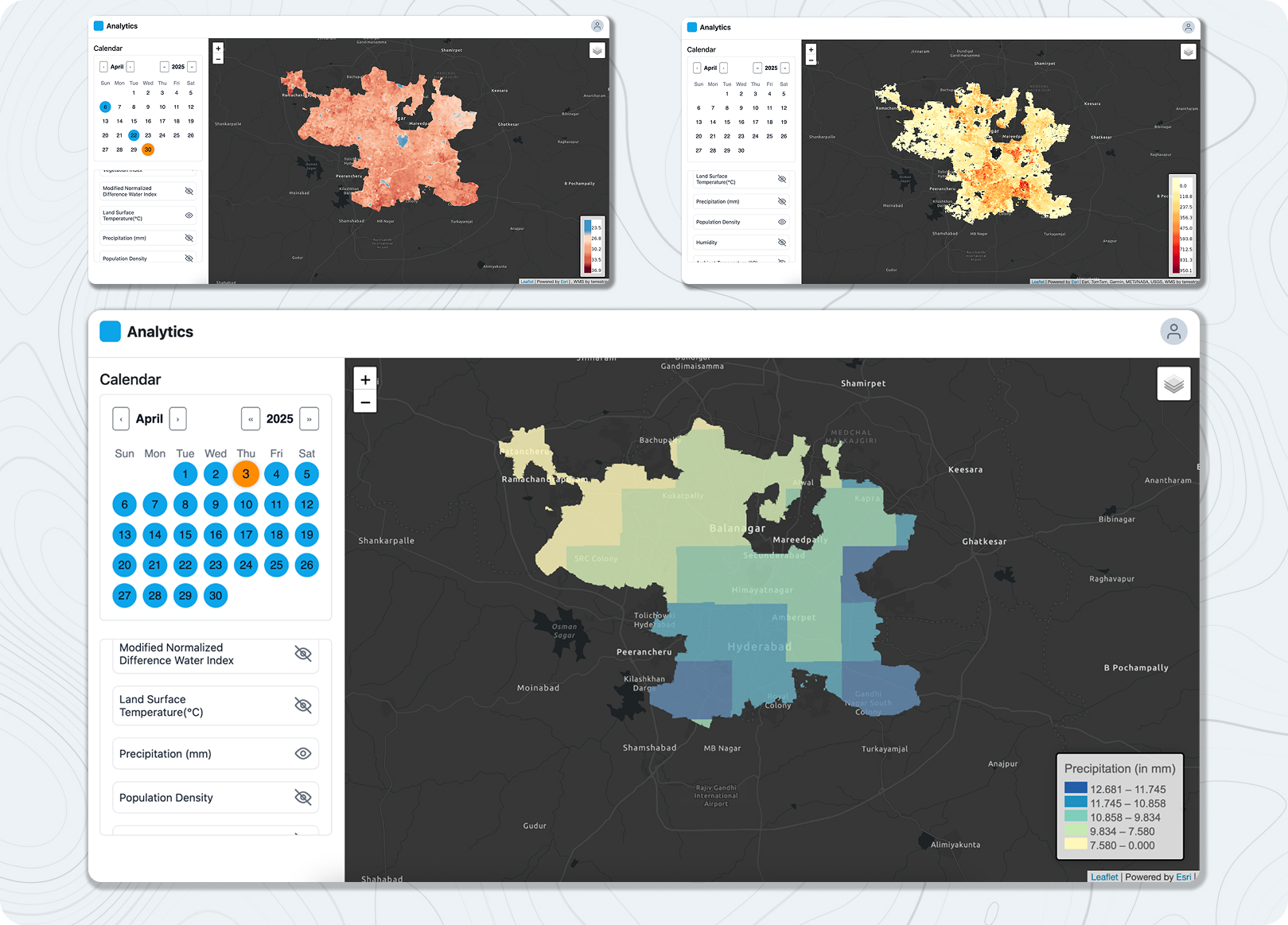
Unleash the combined power of GIS, Spatial Science and Analytics

SPARROW ANALYTICS

“Maps encourage boldness. They’re like cryptic love letters. They make anything seem possible.”

– Mark Jenkins

OUR FEATURED WORK

CoVid-19 Management

MapSights version 1.0 Decision Support System utility for Public Health

Environmental Mapping in Himalayas

Using geospatial data, identify and preserve natural assets

sparrow analytics

Listen | Ideate | Plan | Deliver

Map Sights 2.0

A brand new automated decision support system that leverages the power of GIS, Spatial Science, Machine Learning and Epidemiology. Work began on this phase after the successful deployment of MapSights 1.0

KEY ELEMENTS OF OUR work

We work at the intersection of Geographic Information System (GIS), Mathematical Modeling, Physical Sciences and Technology.

Not limiting ourselves to one stream or genre of application. Because we believe in a symphony of sciences! 

EHSA_CoVid19_May10th
photo-of-turned-on-laptop-computer-943096
scientific-calculator-ii-5775
DSC05746

science COUPLED WITH technology: force multiplier

Technology is agnostic of any specific branch of science. And so through our work, we wish to initiate the dialogue and discussion on leveraging the power of science & technology to usher in a paradigm shift towards scientific decision making in a variety of sectors.