Our Projects

Epidemiology

map sights 1.0

Implemented the GIS enabled analytics platform for pandemic mapping and mitigation strategies. Integration of field and the historic data, along with necessary geo-coding helped the state of Haryana to draw extremely useful insights during the Lockdown phases 1.0 to 4.0. The data insights would help not just with the containment, but also with the ripple effects of the pandemic such as food relief, transportation and grievance redressal. 

At the front-end of the application, the dashboard was an earnest attempt in making our frontline CoVid-19 warriors, our planners and the people, aware and equipped to take informed decisions. While at the back-end, it integrated databases, to predict with higher accuracy the commonly used epidemiological parameters and generate a continuous data time series.

This consultative work was on a pro-bono basis as part of our social responsibility commitment.

Environmental Fluid Mechanics

Springshed development

The gram panchayat of Mitian in Nalagarh tehsil of Solan, is home to numerous fracture springs and rain-fed ponds which were now producing less water each year due to the change in rainfall patterns, loss of moisture retention capability and other anthropogenic factors.

With support from Ambuja Cement Foundation, we completed a full hydrogeological assessment of the area around Mitian village and nearby villages, spread in about 8 sq Kms. We delved deep into streamflows, vegetation, topography, formations and also remote sensing imagery to produce an exciting work on hydrology, satellite imagery and GIS, which helps the planners reverse the recent declining trends observed in spring discharges.

Hydrology using remote sensing

Waterbodies downstream of a dam

This was a project that looked into the state of waterbodies downstream of Bisalpur dam in Tonk and Sawai Madhopur districts of Rajasthan. The state of waterbodies downstream of this dam have been a constant cause of worry for the locals because the environmental flow of River Banas, a tributary of Chambal has been disrupted. As a result, lot of the waterbodies have lost their volume and aquatic wildlife too has dwindled.

This study was to assess the spectral imagery acquired from Landsat missions and the weather data series, by using appropriate image processing and time-series simulation methods.

Sustainable Development Goals (SDGs)

mapping of villages in mine buffer zones

This project was to assess the utilization of fund under the District Mineral Foundation funds. DMF was instituted in March 2015 under the Mines and Minerals (Development and Regulation) Amendment Act as a benefit sharing mechanism with mining-affected communities, recognizing them as partners in natural-resource led development. However there had been calls of review into how much of the funds were actually being spent on the welfare of these communities. 

This project looked at about 100+ mines in districts across Jharkhand, Chhatisgarh and Odisha. Using GIS techniques and data analysis, we estimated the number of households, residents and other parameters such as demographic details, social indicators etc. This work was in support of the report on utilization of DMF funds, authored by the Community Support team at the Centre for Science and Environment (CSE), Delhi.   

Operations Analysis

OP Samvedna - GIS & ANALYTICS support

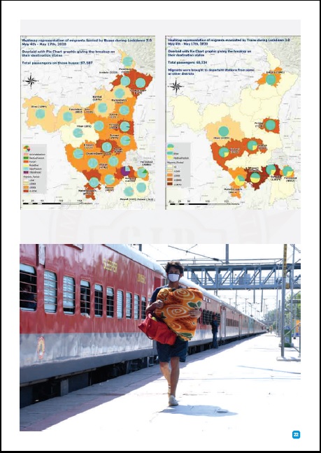
Due to the CoVid-19 pandemic and its collateral effect on the economy, there was a surge of unemployed and homeless people from the unorganized sectors of the economy, many of whom were migrant workers from faraway states. Like the rest of India, state of Haryana was grappling with this issue in the months of March & April 2020 with thousands of migrant workers registering for state support.

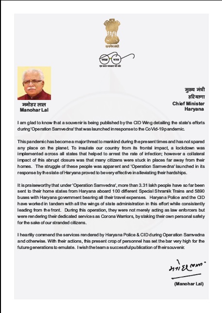
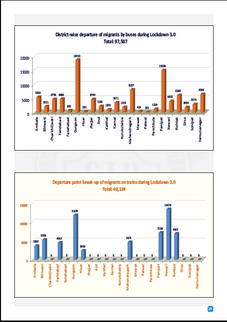
To alleviate their hardships, Haryana government had launched Operation Samvedna (Operation Empathy) under which about four lakh (four hundred thousand) migrant workers along with their families were sheltered, provided with food and medical aid, and eventually repatriated to their home states using the Indian Railways Shramik Express trains and Haryana state roadways buses.

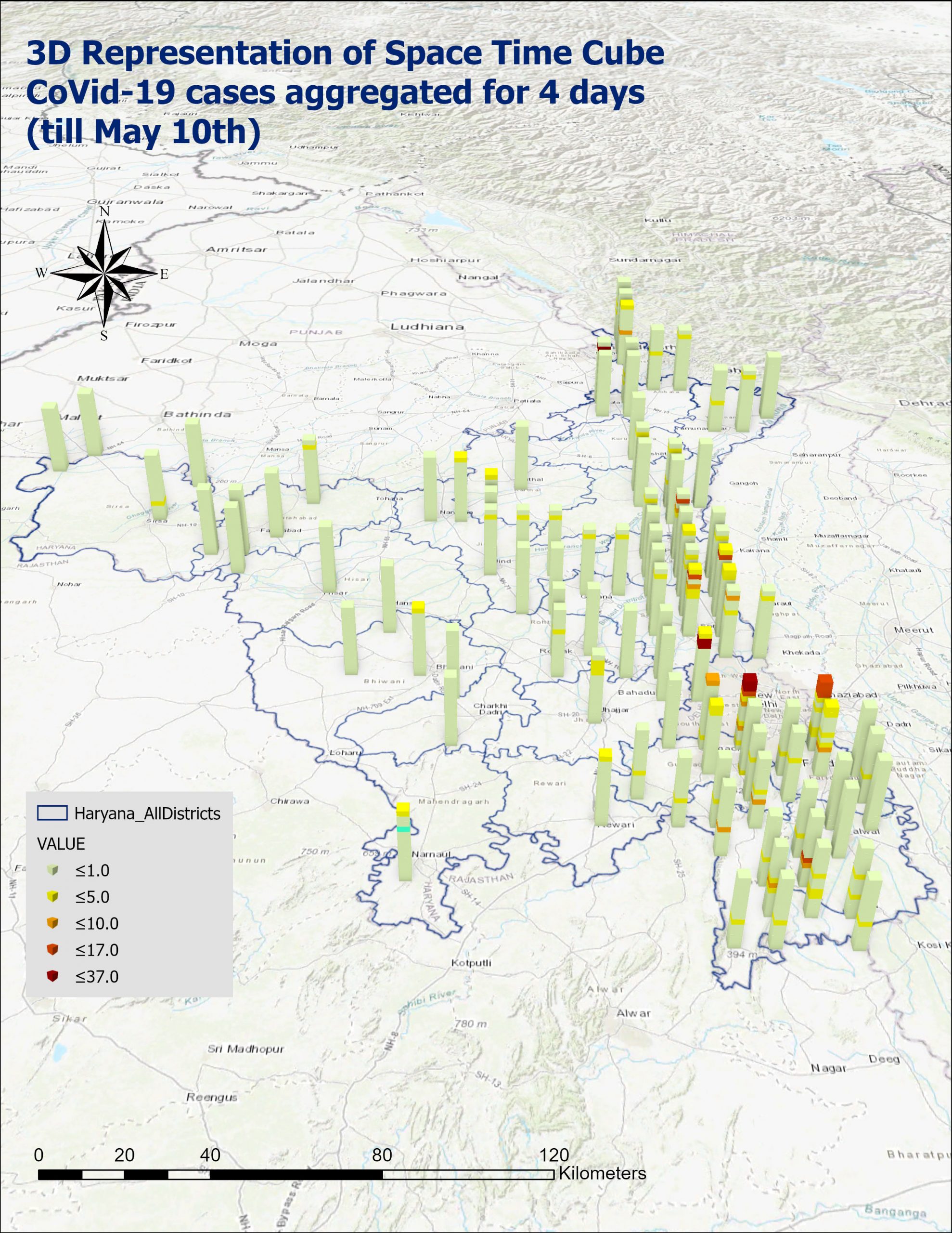
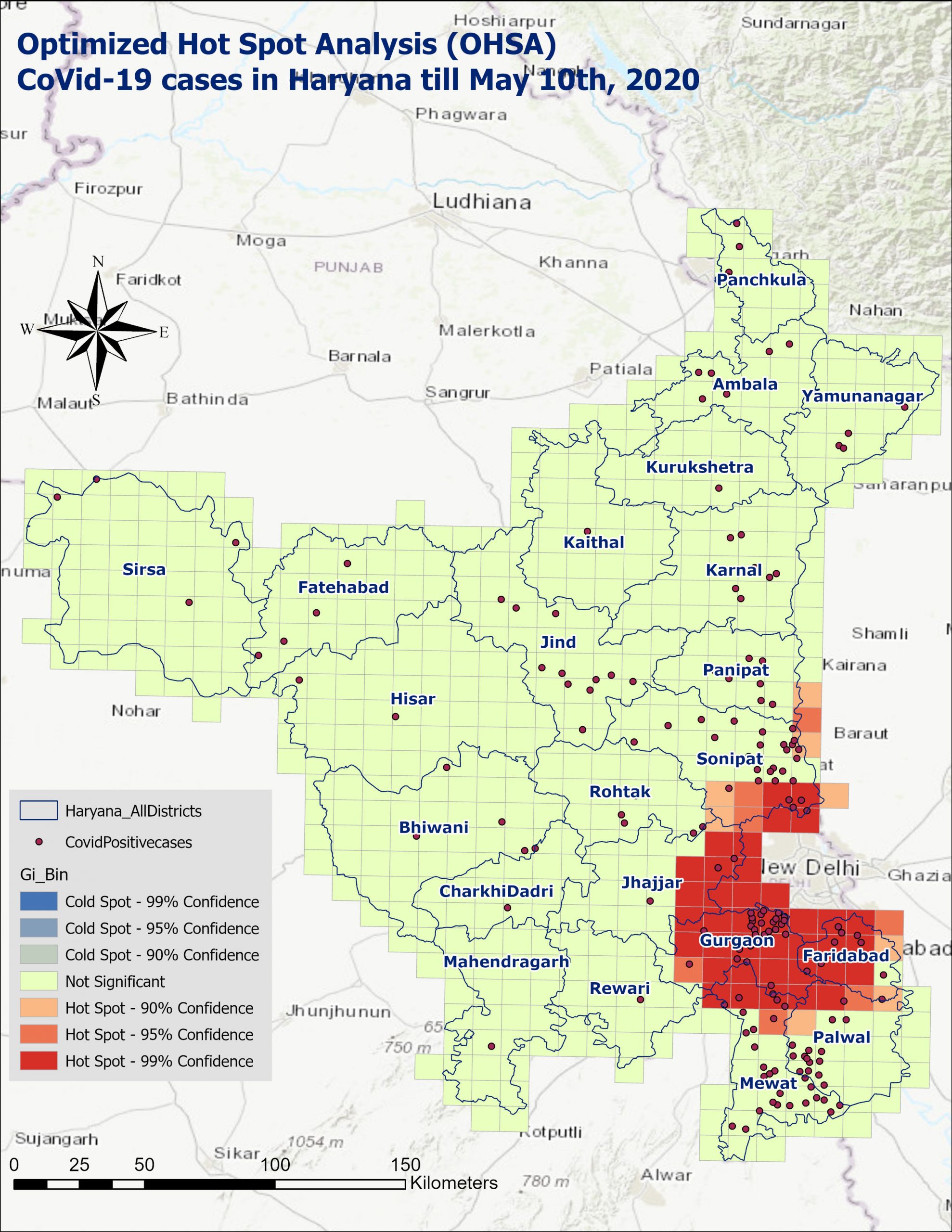
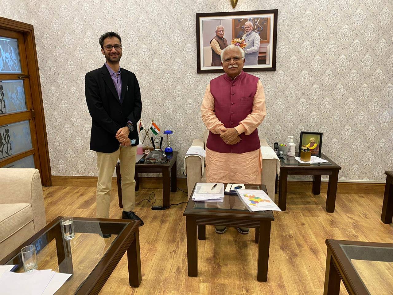
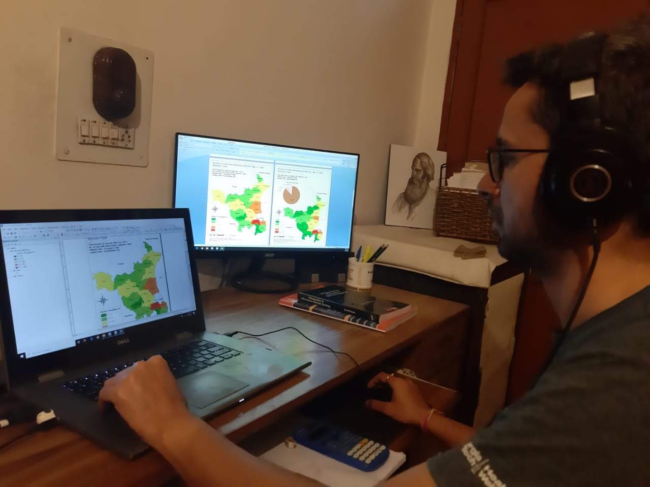
Sparrow Analytics provided GIS and Analysis Support during the operation and published a detailed analysis at its culmination. This analysis work was unveiled by the Hon’ble Chief Minister, Haryana – Sh. Manohar Lal, in the month of July 2020.