Climate Change Mitigation and Management
Under the State Action Plan on Climate Change (SAPCC), Chandigarh has set itself ambitious targets on Clean Air, Carbon cuts, Clean Water and a salubrious environment for all of its residents. A dedicated team of GIS and Earth & Atmospheric Sciences experts was gathered to start a Climate Change Mitigation and Monitoring Cell within the existing Department of Environment setup, in order to work in mission mode on these objectives. Sparrow Analytics was roped in to assist in establishing of the spatial dashboard for the Cell and execute related tasks
● Theorizing and developing various use-cases related to physical environment, their objectives & environmental impact.
● Development of a spatial dashboard based on Free-and-Open-Source-Software (FOSS) philosophy.
● Establishing a data pipeline using APIs for satellite imagery acquisition from USGS' Landsat and ESA’s Sentinel-2 platform.
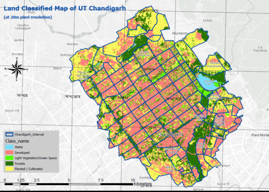
● Developing AI based image analysis tool using Machine Learning techniques for Land Cover classification.
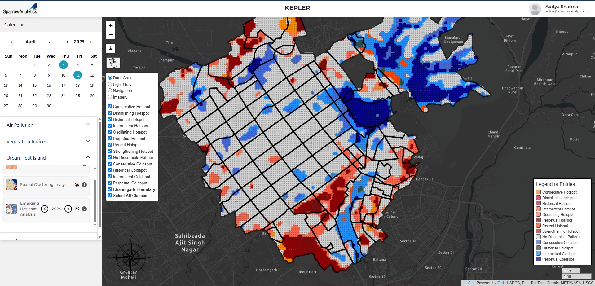
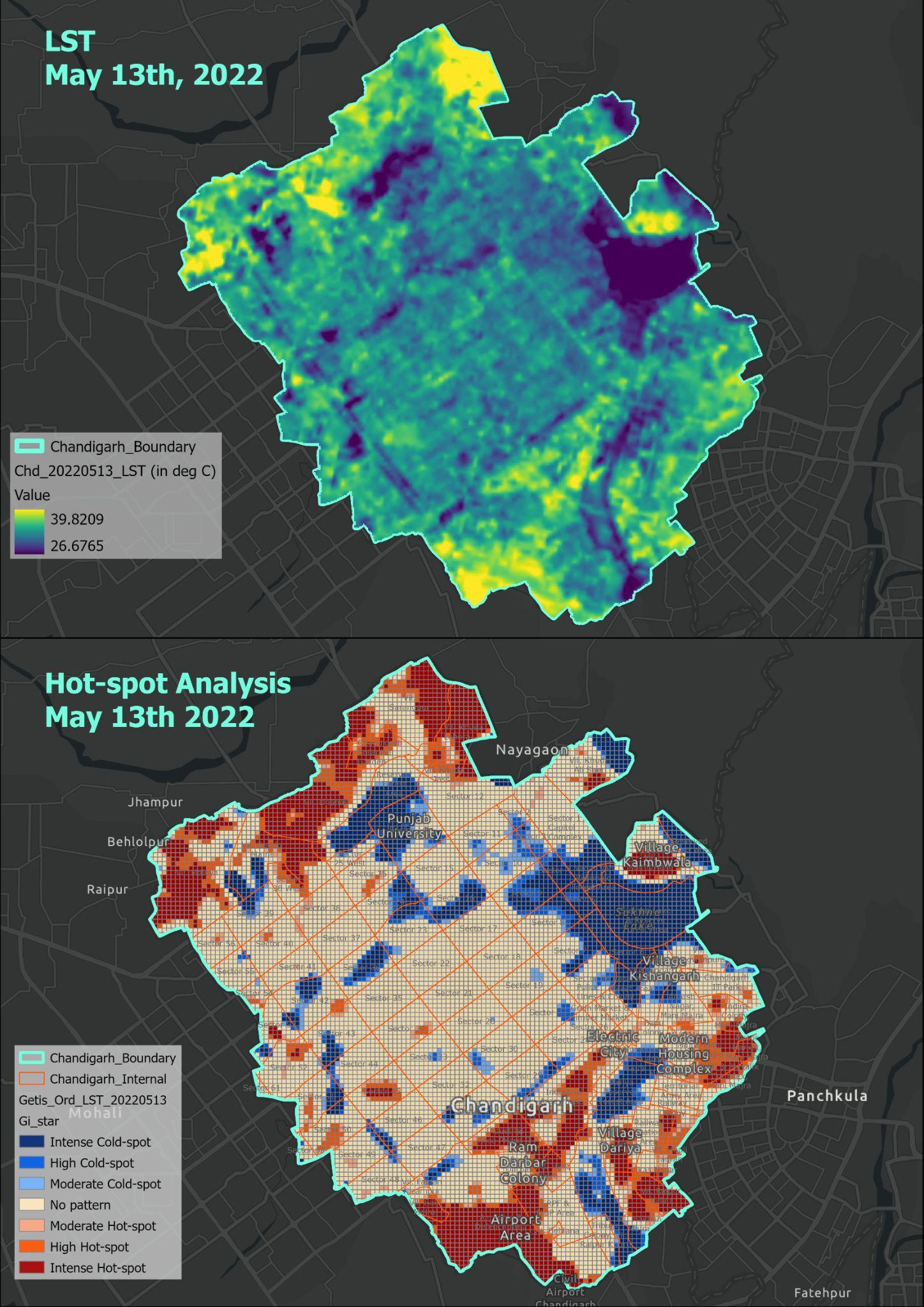
● Development of Spatial Analytics tools for clustering & Hot-spot Analysis.
● Creating an intuitive and easy-to-use dashboard that doesn't require the user to have a prior background in GIS and Spatial Science.
● Built in modular fashion so as to enable subsequent addition of further use cases.
● Chandigarh Administration's Environment Department became the first state or UT government in the country to operate a satellite and ground-data driven Geospatial Platform.
● Environment Department team is now able to issue heat island advisories within the city, based on the processed satellite imagery.
● Using Land Surface Temperature and Urban Heat Island depictions, appropriate countermeasures are now being planned for maximum positive impact over the affected areas.
● Land Cover Classification tool now allows the UT Administration to keep a watchful eye on its Water Bodies, Forest & Tree Canopy Cover, Agricultural land and furthermore classifications of cover type.
● The Administration is now able to deploy its ground resources efficiently, to watch for vegetation health over areas of concern shown via the dashboard.