Geo Tagging of Assets, DSYA
In the sporting powerhouse state of Haryana, infrastructure for various sporting disciplines has been created and is continually getting upgraded. However, where the existing infrastructure was or where is the proposed site for a new one - these questions and many more, needed an answer. And so it was felt by the state that GIS-led approach of planning sports infrastructure was the best way forward.
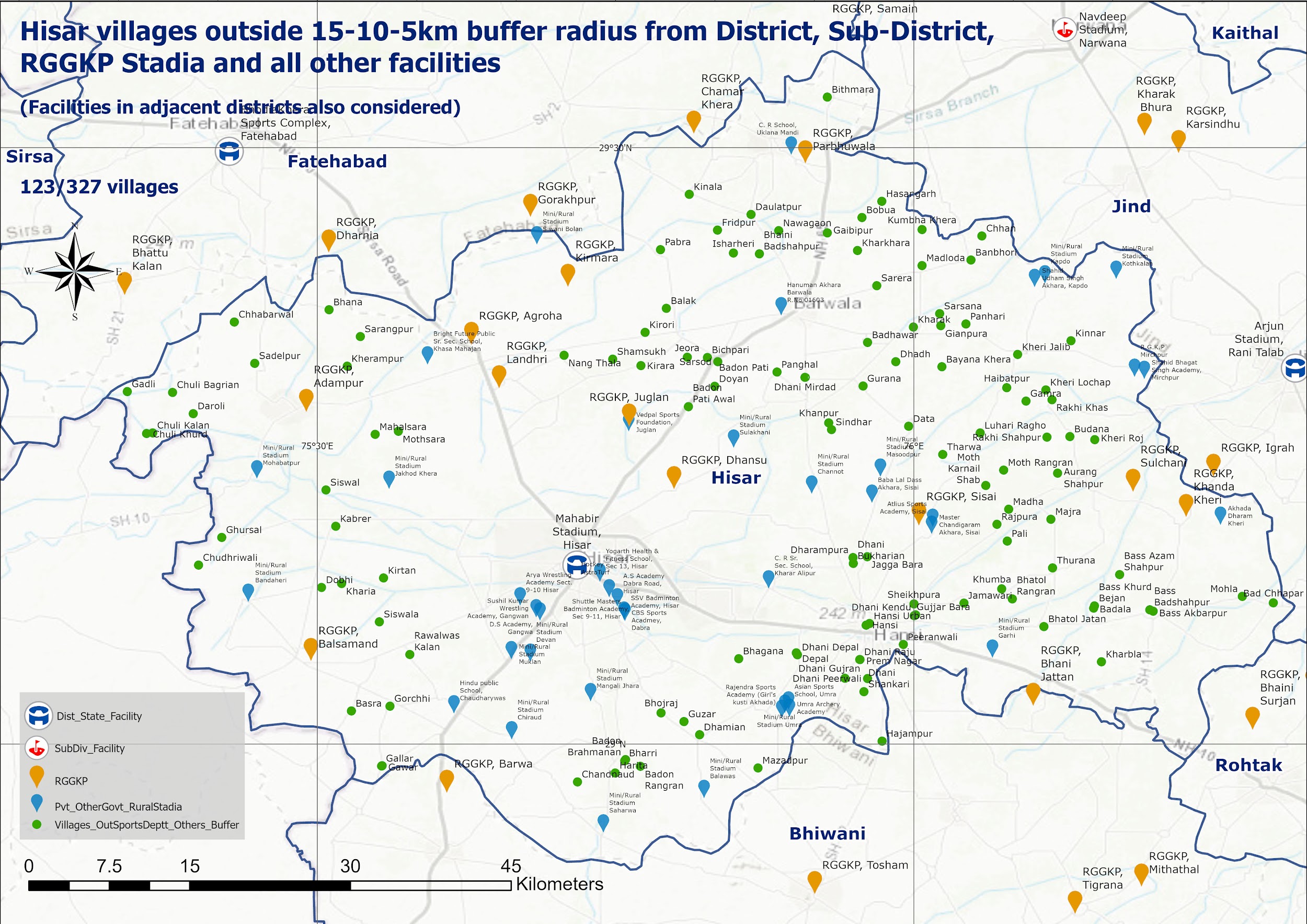
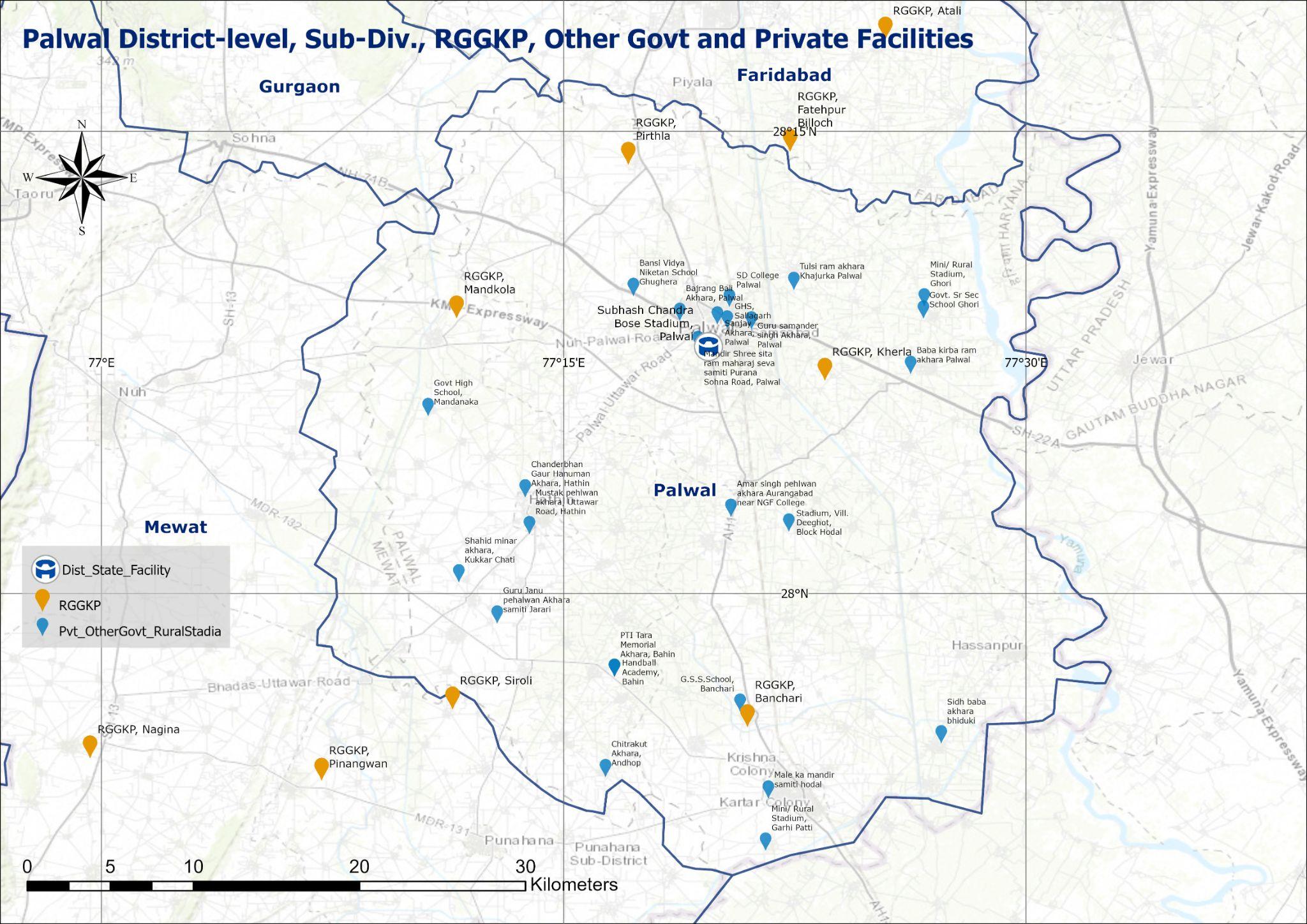
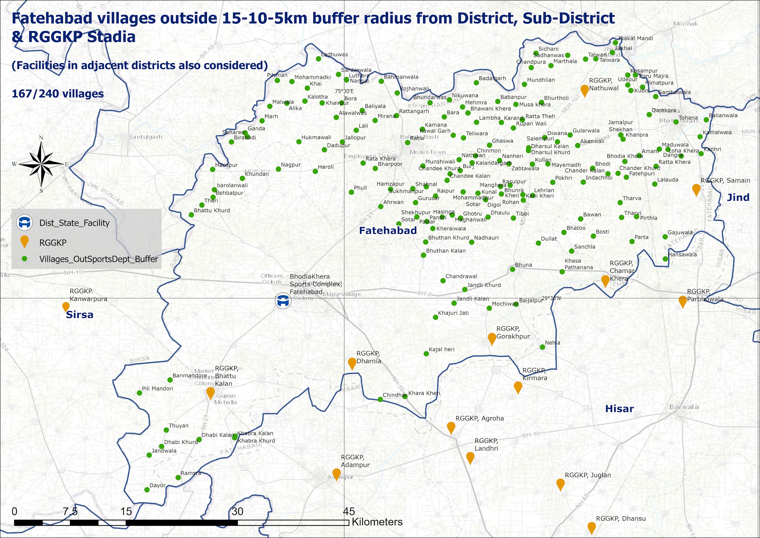
● Data of sporting infrastructure for all disciplines was collected through the District Sports Officers.
● Dedicated sports facilities and sports facilities attached to educational institutions was mapped. Further delineations were done based on equipment, capacity, govt. or private, Panchayat-owned etc.
● Accurate coordinates were collected with ground personnel visiting each of the venue and collecting the Lat-long data.
● Additional Layers such as habitations (villages, towns and cities), transportation hubs, roads were added to the assessment.
● Spatial operations like proximity, distance buffering, routing, geolocating were done to understand the nuances in the given data.
● Each sporting asset's 'population served' in its service area calculated to know if there were enough beneficiaries, as intended.
● GIS philosophy and GIS-assisted decision-making became a part of not just DSYA Haryana's workflows, but even other departments that subsequently made parallel forays into geolocating of assets.
● A dynamic tool created that had multiple layers and could be used by anyone, even those without any GIS background.
● All new sporting infrastructure requests & decisions are now taken up through a process of spatial assessment. This brought the benefits of a particular sporting infrastructure to maximum number of people.
● The entire work eventually was integrated with the CM Haryana GIS portal, a public website to view Haryana Government’s different assets on a geospatial interface.
● Human bias was replaced with scientific decision-making leading to all stakeholders being equally heard and being made a part of the process.