Operation Samvedna
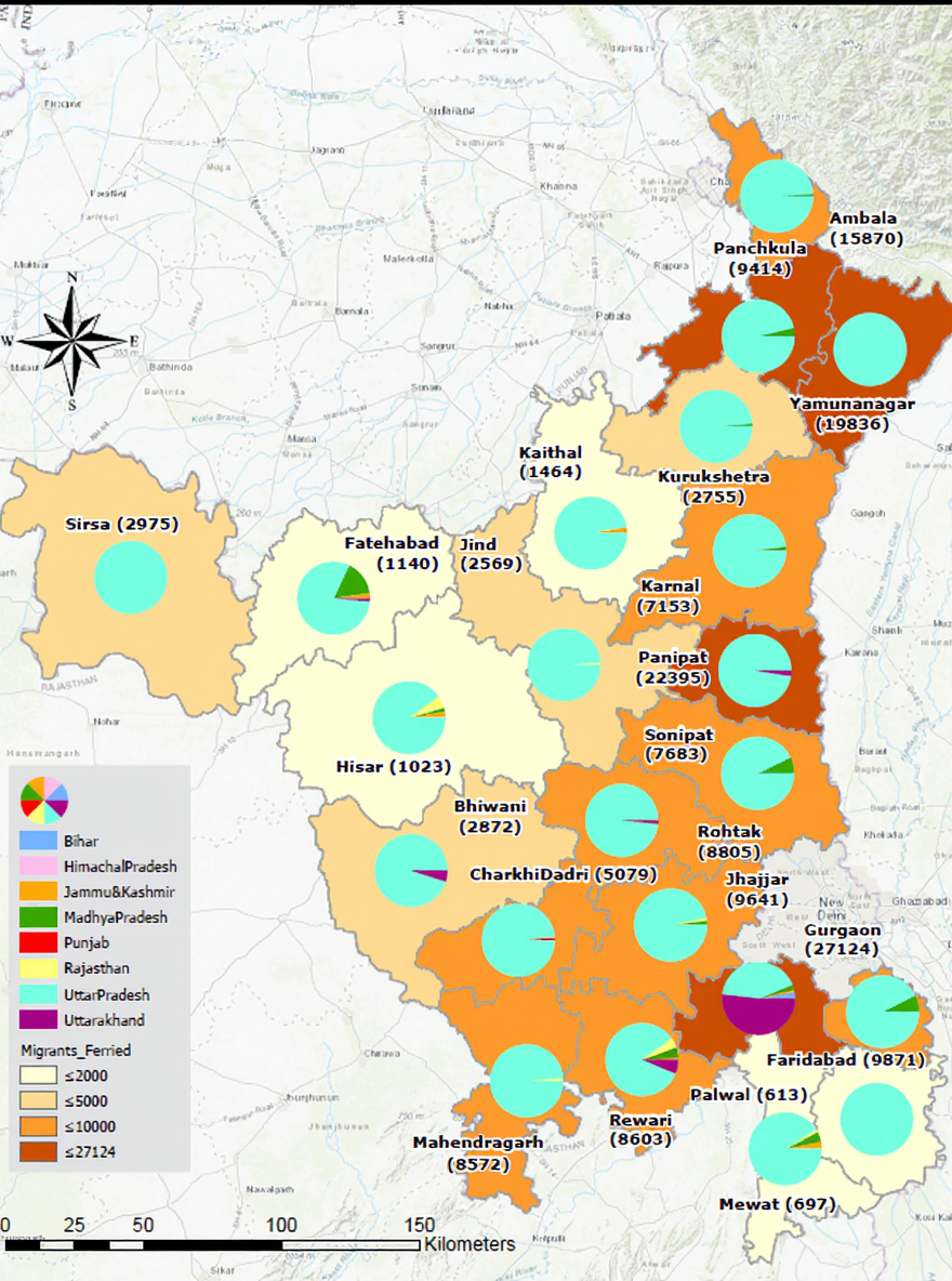
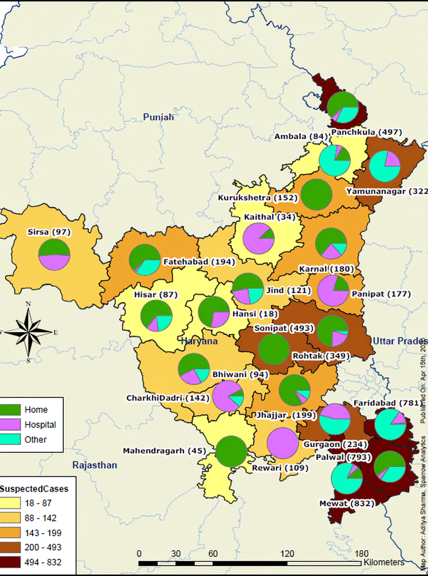
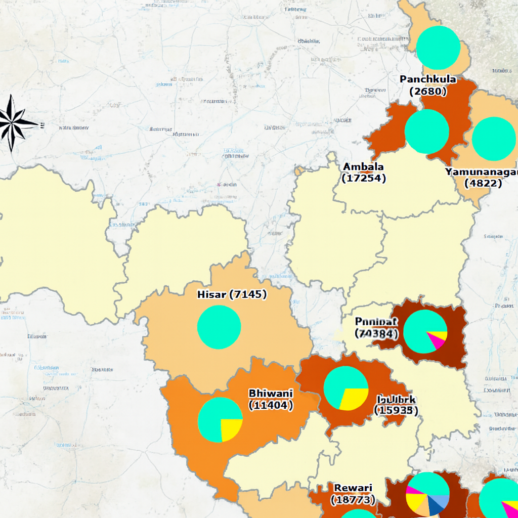
Haryana Police was in the vanguard of the fight against CoVid-19 from get-go. Whether it was lockdown enforcement or identifying migrant labor for a train ride back to their states, police's task were varied and huge at scale. And so, it was felt that GIS and Analytics was something that they have to rely on.
● Sparrow personnel were embedded with the Haryana Police HQ staff to know and understand their data needs.
● Daily reporting was carried out in GIS-friendly format
● Relevant Maps & graphs were fine-tuned to meet the daily reporting requirements of the Police
● Synergistic execution of all tasks on the ground.
● The top brass at the HQs was getting precise updates and accurate ground situation reports.
● Despite a huge migrant population spread across districts, almost everyone got access to food, shelter and medical aid.